Wayfinding map of the Unversity of Colorado at Boulder
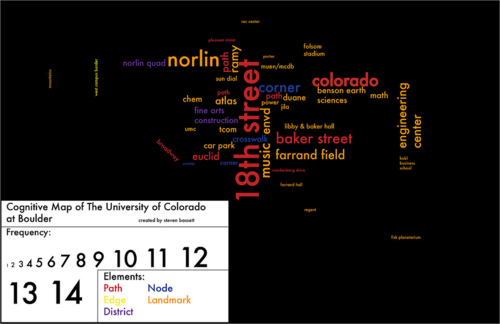
An example of a project in Social Factors of Environmental Design where we were asked to conduct a survey and experiment on how students found their way around campus. The results were used to display this map.